Tsunami Prediction | Vibepedia
Tsunami prediction is a sophisticated branch of geophysics and oceanography dedicated to forecasting the arrival, height, and inundation of seismic sea waves…
Contents
- 🌊 Origins & History
- ⚙️ How It Works
- 📊 Key Facts & Numbers
- 👥 Key People & Organizations
- 🌍 Cultural Impact & Influence
- ⚡ Current State & Latest Developments
- 🤔 Controversies & Debates
- 🔮 Future Outlook & Predictions
- 💡 Practical Applications
- 📚 Related Topics & Deeper Reading
- Frequently Asked Questions
- References
- Related Topics
Overview
Tsunami prediction is a sophisticated branch of geophysics and oceanography dedicated to forecasting the arrival, height, and inundation of seismic sea waves. Unlike weather forecasting, which deals with atmospheric chaos, tsunami prediction relies on the rapid interpretation of undersea pressure changes and seismic data. The field is anchored by the [[national-oceanic-and-atmospheric-administration|NOAA]] and its global network of [[deep-ocean-assessment-and-reporting-of-tsunamis|DART]] buoys, which monitor the ocean floor for millimetric changes in water pressure. Since the catastrophic [[2004-indian-ocean-earthquake-and-tsunami|2004 Indian Ocean Tsunami]], the discipline has shifted from reactive seismic monitoring to proactive real-time modeling. Today, the integration of [[artificial-intelligence|AI]] and high-speed satellite telemetry allows for life-saving warnings to be issued within minutes of a subduction zone rupture, though the 'near-field' challenge of local tsunamis remains a critical frontier in disaster mitigation.
🌊 Origins & History
The formalization of tsunami prediction began in the aftermath of the 1946 Aleutian Islands earthquake, which devastated Hilo, Hawaii. This tragedy led to the 1949 establishment of the Seismic Sea Wave Warning System, the precursor to the [[pacific-tsunami-warning-center|Pacific Tsunami Warning Center (PTWC)]]. Early efforts were hampered by a reliance on land-based [[seismometer|seismometers]], which could detect earthquakes but not confirm if a wave had actually been generated. It wasn't until the late 20th century that the [[national-oceanic-and-atmospheric-administration|NOAA]] developed the technology to move sensors from the coast to the deep ocean. The pivotal shift occurred in 2004, when the lack of a warning system in the Indian Ocean resulted in over 230,000 deaths, prompting a global expansion of the [[intergovernmental-oceanographic-commission|UNESCO-IOC]] coordinated networks. This era transformed prediction from a regional Hawaiian concern into a global security imperative.
⚙️ How It Works
Modern prediction functions through a 'detect-verify-model' workflow that begins the moment a [[tectonic-plate|tectonic plate]] slips. First, seismic networks like the [[global-seismographic-network|Global Seismographic Network]] identify the magnitude and location of an undersea earthquake. If the event is shallow and powerful enough, the system looks to [[deep-ocean-assessment-and-reporting-of-tsunamis|DART]] buoys, which use bottom pressure recorders to detect the weight of a passing tsunami wave. This data is then fed into numerical models like [[short-term-inundation-forecasting-for-tsunamis|SIFT]], which simulate how the wave will interact with coastal bathymetry. These models must account for [[shoaling|shoaling]], where waves slow down and grow in height as they enter shallow water. The final output is a localized forecast of wave arrival times and expected amplitude sent to emergency managers via [[global-telecommunication-system|GTS]].
📊 Key Facts & Numbers
The scale of tsunami prediction infrastructure is immense, featuring a network of 60 [[deep-ocean-assessment-and-reporting-of-tsunamis|DART]] buoys strategically placed across the world's oceans. A standard DART station can detect a tsunami as small as 1 centimeter in the open ocean while sitting under 6,000 meters of water. During the [[2011-tohoku-earthquake-and-tsunami|2011 Tohoku earthquake]], waves reached heights of nearly 40 meters (130 feet) upon impact, demonstrating the extreme energy these systems must quantify. Prediction windows vary wildly; a 'far-field' tsunami may take 15 hours to cross the Pacific, while a 'near-field' event gives residents as little as 10 to 30 minutes to evacuate. The [[national-tsunami-warning-center|National Tsunami Warning Center]] aims to issue initial alerts within 5 minutes of a seismic event. Current global investment in these systems exceeds $100 million annually to maintain sensor integrity and satellite links.
👥 Key People & Organizations
The architecture of global safety is maintained by a handful of critical institutions and scientists. The [[national-oceanic-and-atmospheric-administration|NOAA]]'s Pacific Marine Environmental Laboratory (PMEL) is the primary engine of hardware innovation, having patented the original DART technology. Key figures include [[eddie-bernard|Eddie Bernard]], the former director of PMEL who championed the transition to deep-sea pressure sensors. On the international stage, the [[intergovernmental-oceanographic-commission|UNESCO Intergovernmental Oceanographic Commission]] coordinates the four major regional warning systems. Organizations like [[geoscience-australia|Geoscience Australia]] and the [[japan-meteorological-agency|Japan Meteorological Agency (JMA)]] provide critical regional data that feeds into the global grid. These entities operate 24/7, staffed by geophysicists who must make split-second decisions that carry billion-dollar economic consequences for coastal cities.
🌍 Cultural Impact & Influence
Tsunami prediction has fundamentally altered the coastal psyche, moving from a 'hidden threat' to a managed risk. The 'Great Wave off Kanagawa' by [[hokusai|Hokusai]] remains the definitive cultural icon of the phenomenon, but modern prediction has replaced myth with the 'Tsunami Ready' certification. This program, managed by the [[national-weather-service|National Weather Service]], encourages towns to meet specific criteria for sirens, evacuation maps, and education. In Japan, the cultural memory of the [[2011-tohoku-earthquake-and-tsunami|2011 disaster]] has led to the construction of massive sea walls, though critics argue these create a false sense of security that undermines the predictive alerts. The 'vibe' of the field is one of high-tension vigilance, where a single false alarm can cost millions in lost commerce, yet a missed signal costs thousands of lives.
⚡ Current State & Latest Developments
As of 2024, the field is undergoing a digital transformation led by the integration of [[gnss|Global Navigation Satellite Systems]] for faster earthquake characterization. Traditional seismic methods often underestimate the magnitude of 'mega-thrust' events in the first few minutes; however, [[gnss|GNSS]] can measure the actual displacement of the Earth's crust in real-time. Researchers at [[caltech|Caltech]] and the [[university-of-tokyo|University of Tokyo]] are currently testing fiber-optic sensing, using existing undersea internet cables as giant seismic arrays. This technique, known as [[distributed-acoustic-sensing|Distributed Acoustic Sensing (DAS)]], could potentially fill the massive gaps between existing buoys. Furthermore, the [[united-nations|UN]] Ocean Decade (2021-2030) has set a goal to make 100% of at-risk coastal communities 'Tsunami Ready' by the end of the decade.
🤔 Controversies & Debates
The central controversy in tsunami prediction is the 'False Alarm vs. Fatal Silence' trade-off. Over-warning leads to 'warning fatigue,' where the public ignores future alerts, as seen in several evacuations in [[chile|Chile]] and [[alaska|Alaska]] where the predicted wave was negligible. Conversely, the 2018 Palu tsunami in [[indonesia|Indonesia]] exposed a lethal flaw: the existing buoy network was broken, and the localized nature of the landslide-triggered wave bypassed the standard seismic models. This has sparked a fierce debate over whether governments should invest in expensive deep-sea hardware or cheaper, community-based 'last mile' solutions. There is also ongoing tension regarding data sharing; some nations are hesitant to share high-resolution bathymetry data due to naval security concerns, even though it is vital for accurate inundation modeling.
🔮 Future Outlook & Predictions
The future of prediction lies in the 'Internet of Underwater Things' and machine learning. By 2030, we expect to see the deployment of [[autonomous-underwater-vehicles|AUVs]] that can loiter near subduction zones, providing a mobile sensor grid that supplements fixed buoys. [[google|Google]] and other tech giants are exploring how their undersea cable infrastructure can be dual-purposed for environmental sensing. We are moving toward 'probabilistic tsunami forecasting,' which provides a range of likely outcomes rather than a single height estimate, allowing for more nuanced emergency responses. The ultimate goal is the 'zero-minute' warning, where pre-seismic signals—such as electromagnetic changes in the crust—are used to predict the earthquake itself, though this remains the 'holy grail' of geophysics and is currently highly speculative.
💡 Practical Applications
Practical application of tsunami prediction extends beyond immediate evacuation to long-term urban planning and insurance. The [[federal-emergency-management-agency|FEMA]] uses tsunami inundation maps to set building codes and insurance premiums in high-risk zones like the [[cascadia-subduction-zone|Cascadia Subduction Zone]]. Port authorities in major hubs like [[port-of-los-angeles|Los Angeles]] and [[port-of-yokohama|Yokohama]] use predictive data to order ships to sea, as large vessels are safer in deep water than when battered against a pier. In the tourism sector, resorts in the [[maldives|Maldives]] and [[thailand|Thailand]] integrate these alerts into their guest safety protocols. Even the telecommunications industry uses this data to reroute traffic away from cables that might be severed by turbidity currents following a tsunami-generating event.
Key Facts
- Year
- 1949
- Origin
- Hawaii, USA
- Category
- science
- Type
- technology
Frequently Asked Questions
How accurate are tsunami arrival time predictions?
Arrival time predictions are remarkably accurate, often within a margin of 5 to 10 minutes for far-field tsunamis. This is because the speed of a tsunami is determined by water depth—calculated as the square root of gravity times depth—which is a well-mapped constant in the open ocean. Using tools like [[short-term-inundation-forecasting-for-tsunamis|SIFT]], [[noaa|NOAA]] can project the wave's path across the Pacific with high confidence. However, the accuracy of the wave's height is much harder to predict, as it depends on complex coastal features and the specific orientation of the seafloor rupture.
Can we predict a tsunami before the earthquake happens?
Currently, no; we cannot predict the earthquake that triggers a tsunami, only the wave's behavior once the earth has already moved. While some researchers study 'precursory signals' like electromagnetic fluctuations or animal behavior, there is no scientifically validated method for pre-seismic prediction. The focus remains on rapid detection via the [[global-seismographic-network|Global Seismographic Network]] to maximize the warning window after the event occurs. The goal is to reduce the 'analysis lag' from minutes to seconds.
What is a DART buoy and how does it work?
A [[deep-ocean-assessment-and-reporting-of-tsunamis|DART]] (Deep-ocean Assessment and Reporting of Tsunamis) buoy consists of two parts: a Bottom Pressure Recorder (BPR) on the seafloor and a surface buoy. The BPR detects the slight increase in water pressure as a tsunami passes overhead—even a wave only 1cm high—and sends an acoustic signal to the surface buoy. The buoy then relays this data via [[iridium-communications|Iridium satellites]] to warning centers. This system is the only way to confirm a tsunami is actually in the water before it hits a coastline.
Why did the 2018 Palu tsunami fail to be predicted accurately?
The 2018 Palu event in [[indonesia|Indonesia]] was a 'black swan' for prediction because it was triggered by an undersea landslide and a strike-slip earthquake, which typically don't cause large tsunamis. The existing sensors were optimized for subduction zone 'mega-thrust' events, not localized landslides. Furthermore, many of Indonesia's [[deep-ocean-assessment-and-reporting-of-tsunamis|DART]] buoys were inoperable due to vandalism or lack of maintenance. This tragedy highlighted the need for more dense, locally-focused sensor networks in complex geological areas.
How does AI improve tsunami forecasting?
[[artificial-intelligence|AI]] and machine learning are being used to run thousands of 'pre-computed' scenarios in seconds, matching real-time seismic data to the closest historical or modeled event. Traditional numerical models can take 10-20 minutes to run; AI-driven models like those developed at [[rice-university|Rice University]] can provide inundation estimates in under a second. This speed is critical for 'near-field' warnings where every second counts. AI also helps filter out 'noise' from sensors, such as passing ships or whales, which can cause false alarms.
What is the 'Tsunami Ready' program?
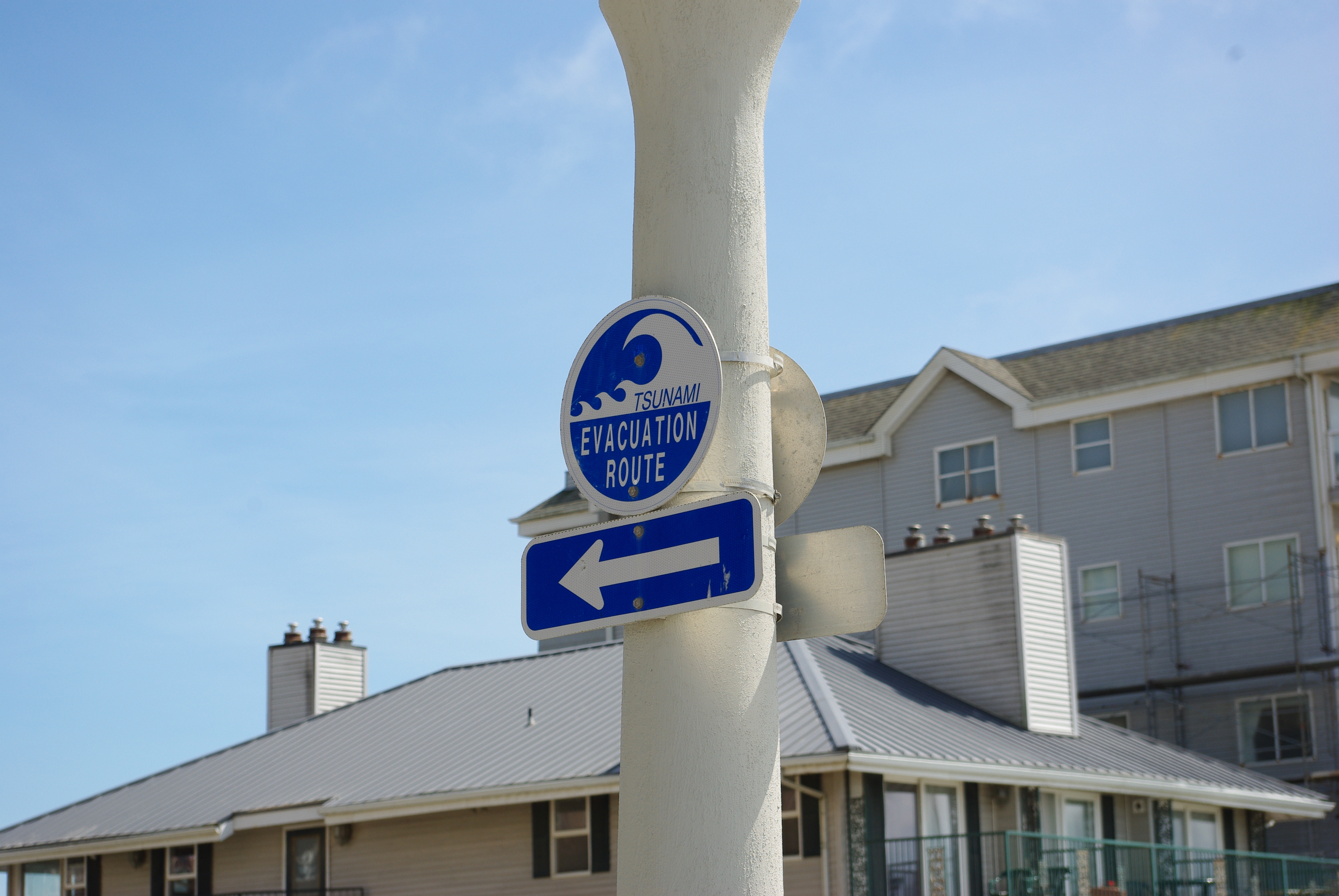
The 'Tsunami Ready' program is a voluntary community recognition program administered by the [[national-weather-service|National Weather Service]] to improve local preparedness. To be certified, a community must have a 24-hour warning point, multiple ways to receive alerts, and established evacuation routes with clear signage. It shifts the focus from the technology of prediction to the sociology of response. As of 2024, hundreds of communities globally have adopted these standards to ensure that a 'perfect prediction' isn't wasted by a 'poor response.'
What are the limitations of current prediction technology?
The primary limitation is the 'blind zone' near the earthquake epicenter, where the wave arrives before the data can be fully processed. Additionally, the deep-ocean buoy network is sparse; there are vast stretches of the South Atlantic and Indian Oceans with no coverage. Maintenance is also a massive hurdle, as [[deep-ocean-assessment-and-reporting-of-tsunamis|DART]] buoys are expensive to service and prone to hardware failure in harsh marine environments. Finally, predicting tsunamis caused by non-seismic events, like the [[hunga-tonga-hunga-haapai|Hunga Tonga]] volcanic eruption, remains extremely difficult for current seismic-centric models.